Applied research project a step toward greater data sovereignty
NAIT-developed tool will factor in decision-making, well-being and autonomy
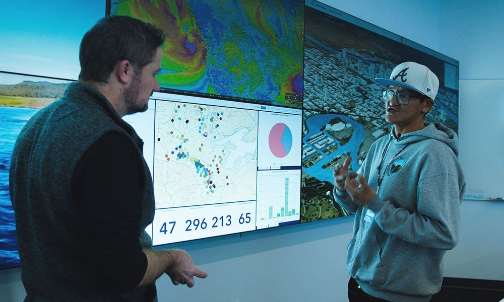
In a box in NAIT’s Data Visualization Lab – a space with a “mission control” vibe, featuring video screens, projectors, touch-tables and powerful computers – is a collection of obsolete tech from bygone eras.
“I've got this informal scavenger hunt going on with folks,” says Dave Blaine of his colleagues in applied research and elsewhere at the polytechnic. “Anytime they find a legacy data-reader, they bring it to me.”
Given the preciousness of the information Blaine works with as a geographic information system (GIS) analyst, that pile of old disk drives and media players is arguably as important as anything else in the lab.
While much of the data available to him is current, some dates back decades. It’s on relics like floppy disks, physical zip drives, a Sony minidisc. It includes maps, GIS data, vegetation studies, mining impact reports, and even audio recordings, all from traditional territories of Indigenous communities.
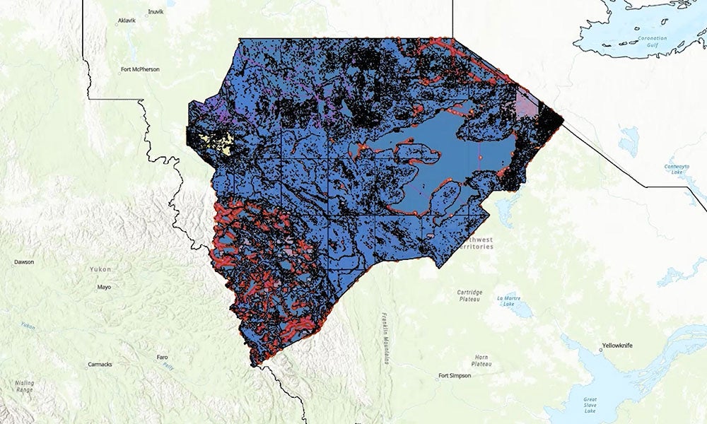
Since January 2022, Blaine has migrated such data to web-based platforms known as Indigenous-led community atlases. They’re “living” maps, depictions of information across time and space that evolve with the addition of data representing physical, biological, cultural and other changes to the landscape.
For the first communities to use them, in the Sahtú region of the Northwest Territories and Peavine Métis Settlement in northern Alberta, they’re a merging of the past and present that may point to a new era of well-being, prosperity and autonomy.
“What [this] has enabled us to do is give a voice to our data, and give us control over that voice, and how it’s handled and managed,” says Zachary Gauchier, Peavine’s first resident IT tech.
“For my community, this is the first step toward data sovereignty.”
Living proof
Data takes different forms depending on whom it belongs to and what it’s about.
In Peavine, for example, it may be studies – done by community members – on foreign chemicals in soil or water near local industry projects. In Sahtú, data may be traditional knowledge about caribou populations, or reasons for the significance of Bear Rock, a sacred regional landmark.
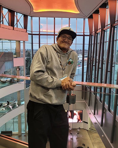
“When you sit down with an Elder and listen, that Elder has the equivalency of a PhD,” says Jonathan Yakeleya (above), research coordinator with Sahtú Renewable Resources Board and a resident of Tulita, a community of 500 Dene, Métis and non-Indigenous residents.
“The stuff that they tell you is not just stories or fiction. It is life – living proof of what is happening.
“So having that all in the software for our people is great.”
Collecting measurements and stories in the atlases is at the heart of the data sovereignty Gauchier hopes Peavine and other Indigenous communities achieve.
As the First Nations Information Governance Centre (FNIGC) writes in a 2019 paper, “data sovereignty is a crucial step toward realizing full self-government of First Nations,” an inherent right eroded by the Indian Act of 1867 yet guaranteed by the Constitution Act of 1982.
High among the reasons behind that realization is that “[data] has the potential to positively or negatively influence decision making, policy, and social change, and ultimately to transform nations.”
What’s more, enabling communities to gather and use their data as they see fit is a necessary departure from a past in which studies were conceived and conducted by colonial governments. The results have been “countless laws, policies, and programs … that are culturally distorted, discriminatory, oppressive, and harmful to First Nations,” writes FNIGC.
Blaine doesn’t involve himself in decisions about the communities’ data. He prepares and uploads it, ensuring it’s available for any use. “It's not on me to decide what's relevant or germane or trivial,” he says.
Being from elsewhere, why would he? That data, says Yakaleya, is essentially “our environment that we’re living in.”

Sometimes, that environment is shared with others, also from elsewhere, with positive and negative effects.
Peavine hosts oil and gas activity into which the community would like to have more input. The atlas could outline the location of important hunting grounds, suggests Gauchier (above), with the need to preserve them emphasized by an overlay of data that illustrates wellsite impact.
“That becomes a tool of knowledge,” he says, and perhaps one for improving well-being and advancing economic growth. “We never had this kind of technical advancement before.
“It’s going to change the way our community is and operates forever.”
“The great big aspiration”
The Indigenous-led community atlases project started after an existing NAIT emergency management mapping project was reimagined for the Sahtú Renewable Resources Board (supported by funding from Northwest Territories Environmental Studies Research Fund, Natural Sciences and Engineering Research Council of Canada, and the University of Alberta Adaptation Resilience Training Program).
It extended to Peavine last July thanks to funding from the Suncor Energy Foundation (which reduces the cost of the work for the communities; Ermineskin Cree Nation is also set to participate).
Now, the project is both winding down and ramping up.
Blaine is still sifting through data with his collection of museum-grade and cutting-edge technology, and uploading it to atlases for both locations. He sees a time, however, when that’s not the case.
The enthusiasm shown by Gauchier and Yakaleya for the project makes Blaine optimistic that he’ll be replaced. He sees young people like them as “the power users who will be able to take the system and carry on with it,” making him as “obsolete” as those dusty gadgets in his lab.
But he also hopes this project sets a precedent that leads to a pattern. NAIT looks forward to partnering with other Indigenous communities to create atlases of their own.

“They can [build] it and do cool stuff, and then we go to another community and start it all over again,” Blaine says. “That is the great big aspiration here.” (To help, the project was granted $1 million by Prairies Economic Development Canada in August 2025.)
In the meantime, the importance of the atlases grows as time inevitably alters the land. “The world is changing as we speak,” says Yakaleya.
The Government of the Northwest Territories is planning a two-lane gravel highway through the Mackenzie Valley. It will run 321 kilometres from Wrigley in the south to Normal Wells in the north. For some of the communities along the way, including Tulita, it will be the first road to offer permanent, year-round access.
“That’s going to have a huge impact on our people,” says Yakaleya. “We’re going to open a door for industries and more people to come here and make an impact.”
He sees data as a way to help make that more positive, or at least less negative. And he sees a role for himself in that, if not an obligation.
Yakaleya thinks about those who have passed down their knowledge to him. He knows what it means to the communities of the Sahtú today. And he thinks about his four-year-old daughter. He doesn’t know exactly what information she’ll need one day, but he knows he can make sure she has access to it when she does.
“Now,” says Yakaleya, “it’s my turn.”
Banner image by Dave Blaine
If you enjoyed that article, try these:
Northern Alberta Institute of Technology
Mailing Address:
11762 - 106 Street
Edmonton, AB, Canada, T5G 2R1
At NAIT, we honour and acknowledge that the land on which we learn, work and live is Treaty Six territory. We seek to learn from history and the lessons that have come before us, and to draw on the wisdom of the First Peoples in Canada. Only through learning can we move forward in truth and reconciliation, and to a better future together. Read more
About techlifetoday
Techlifetoday is the source for NAIT alumni and students to discover news about the polytechnic, and insights, advice and inspiration from the NAIT community to help them build successful careers and lead fulfilling lives.